
Find Pueblo Street Records by Address
A Pueblo street directory search works best as a chain, not a name list. Start with the full street number, suffix, city, and unit exactly as recorded. The Pueblo County Assessor Property Search can tie that location to a parcel, situs or location address, mailing field, legal description, value history, and transfer summary. That is an ownership signal, not proof of who lives there. GIS adds geometry and address points. The recorder connects a parcel to a deed or plat. Elections supplies a separate, date-sensitive registration clue, while a Historical Society criss-cross directory can show a past household or business. Keep each label intact: owner, mailing address, voter residence, and historical occupant answer different questions.
- Run the street number and name through the assessor quick search, or use the advanced location fields when a full-street range is needed.
- Record the parcel ID, exact situs, mailing field, legal description, and any transfer reception number before moving to another source.
- Open the Pueblo County Official Records Search with the legal description, reception number, or grantor and grantee names. Obtain the actual instrument when the index summary matters.
- Use the Colorado voter lookup for a full name, ZIP, and birthday clue, then use Pueblo County Elections when a by-address report is needed.
- Check the Historical Society or Rawlings street-index material for a dated criss-cross entry and preserve the edition, page, and original address form.
The chain moves from address to parcel, then from parcel to legal record, election clue, and historical directory. It narrows a street question without claiming that every name found is a current resident.
Pueblo Address Baselines and Number Rules
The Pueblo City-County Addressing Standards, issued in May 2010, separate a site address for the parcel, a building address, an establishment address for a suite or unit, and a mailing address. Within the City of Pueblo, First Street and Santa Fe Avenue are the baselines. County references use I-25 and US Highway 50. House numbers generally run odd on the north or west side and even on the south or east side, although circular streets are an exception.
The standards also explain why a street directory can split one base number into several records. Multiple buildings may receive separate numbers. Multi-unit places keep the main number and add a secondary identifier such as APT, BLDG, DEPT, FRONT, HANGAR, REAR, SPC, STE, UNIT, or SKY. The master address database preserves an alias roadway name when a street was renamed or has a common historical form. Keep that alias beside the modern value rather than silently rewriting it.
- Parcel
- A mapped legal land unit with an assessor parcel number, which may contain more than one structure.
- Situs address
- The location address tied to the parcel or structure, distinct from the tax mailing address.
- Plat
- A recorded map that lays out lots, blocks, streets, or easements and can clarify a legal description.
- Criss-cross directory
- A reverse directory arranged by address or street, useful for a dated occupant or business clue.
Match a Pueblo Address to the Assessor
The assessor portal has Quick Search, Parcel and Sales Search, Tax Search, GIS, and New Search tabs. Quick Search accepts an ID, name, or location with autocomplete. The advanced route lets a researcher narrow a street by number range, street-name prefix, city, subdivision, neighborhood, or neighborhood group, then sort by property ID, owner, site address, last sale price, or last sale date. Capture the parcel card before relying on a name. It can show the owner field, situs and mailing addresses, use code, tax district, neighborhood, legal description, values, notices, and selected transfers.
Parcel 05-242-02-004 is a useful Pueblo example. The card names BAKER MORGEN / MOBLEY ALYSSA and lists 3023 2ND AVE, PUEBLO, CO 81008-1103, RE-RES use, tax district 60B, and neighborhood 60 Central Park. Its legal description is LOTS 18 + 19 BLK 5 GRANDVIEW PL. The 2026 card shows building value $223,910, land value $22,000, full market value $245,910, taxable value $221,319, and assessed value $15,049. It also carries value history for 2025 through 2020 plus transfer, building, land, and notices sections. Those fields describe a parcel and tax record. They do not establish current household membership.
The Pueblo County Assessor sample parcel supplies a concrete view of the fields a street-by-address search can preserve.
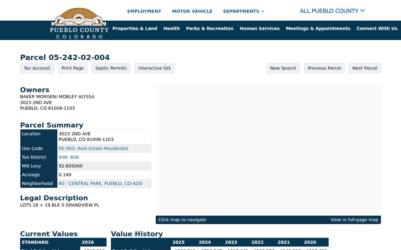
The parcel number, legal description, and separate situs and mailing fields show why a Pueblo street directory result needs field labels beside every name.
Pueblo Assessor Search Fields
For a narrow address search, begin with the current owner and location fields. The portal uses text or autocomplete for names and street names, numeric ranges for street numbers, and multi-select lists for several geographic categories. The live lists include PUEBLO and PUEBLO WEST among other locations, so the city value should be checked against the actual situs and jurisdiction.
| Field Label | Type | Required | Options / Format Notes |
|---|---|---|---|
| Owner Name | Text / autocomplete | Optional | Current owner or name clue |
| Location Street Number From / To | Numeric or text range | Optional | Set a full street span or one number |
| Location Street Name starts-with | Text / autocomplete | Optional | Use the street stem and preserve the suffix |
| Location City | Multi-select | Optional | Live values include Any, AVONDALE, BEULAH, BOONE, COLORADO CITY, PUEBLO, PUEBLO WEST, RYE, and VINELAND |
| Subdivision | Multi-select | Optional | Live list; Ctrl-click can select multiple values |
| Neighborhood | Multi-select | Optional | Assessor neighborhood codes, not the 2018 city map labels |
| Neighborhood Group | Multi-select | Optional | Codes include COMM, MN, MH, PI, RES, RESCN, RESMU, and RESTH |
| Parcel Number Contains / Range | Text and numeric ranges | Optional | Match a known parcel or a parcel interval |
| Tax District | Multi-select | Optional | Live district codes include 60B and many other codes |
| Property Use | Multi-select | Optional | MH, PI, RE-COMM, RE-CONDO, RE-LAND, RE-MU, RE-RES, RE-TH, MN, or SA |
| Zone | Multi-select | Optional | Land-zone values are live and should be read as the portal defines them |
| Residential / Commercial SqFt | Numeric range | Optional | Use only when a size filter is useful |
| Acreage | Numeric range | Optional | Parcel-area filter |
| Original Construction Year From / To | Numeric range | Optional | Building-age filter when present |
| Initial Sort Field | Select | Optional | Property ID, Owner Name, Site Address, Last Sale Price, or Last Sale Date |
| Sale Data | Mixed controls | Optional | Seller/buyer, sale price/date, Vacant/Improved, Market Sale Any/Qualified/Unqualified, reception number, instrument type |
| Tax Search | Mixed controls | Optional | Owner starts-with, account type Any/Real Property/Personal Property, account number, schedule code, street, city, district, tax year, balances, and delinquency ranges |
Tax years visible in the live controls run from 2025/2026 back through 1979/1980, with an Any Year choice. Sale dates use mm/dd/yyyy. The full instrument-type and tax-district lists are dynamic, so a saved search should record the inspection date and the exact selected value.
Pueblo Street Records at a Glance
A street directory becomes more useful when each record set keeps its own role. The assessor is strongest for parcel ownership and tax fields. GIS is strongest for geometry and layer context. The Recorder holds the deed and plat trail. Elections can provide a public registration clue under Colorado rules. Permit custodians change with physical jurisdiction and issue date. Historical directories add a dated occupant or business entry rather than a current roll.
| Record Set | Keeper | What It Shows | Access |
|---|---|---|---|
| Assessor parcel card | Pueblo County Assessor | Parcel ID, owner, mailing and situs fields, legal description, values, notices, and selected transfers | Assessor portal and GIS; current data observed through 2026 |
| GIS parcel and address layer | Pueblo County GIS and City GIS | Parcel geometry, address points, roads, districts, and neighborhood context | ArcGIS viewers or county map/data request; record the layer date |
| Recorder deed index | Pueblo County Clerk & Recorder | Grantor, grantee, reception number, instrument, date, legal description, and document image when available | Free Tyler index, counter, phone, email, or CORA; images may have fees |
| Planning and permit record | SoCoBD, City routes, or County Building Division | Address-keyed project, inspection status, applicant or contractor context | Historical lookup, current jurisdiction portal, counter, or request route |
| Voter record | Pueblo County Elections and Colorado SOS | Public registration fields, precinct or district, status, and released history | GoVote, county report request, SOS request, or CORA; confidentiality applies |
| Historic directory or map | Historical Society, Rawlings, LOC, or City preservation | Year-specific occupant, business, street form, footprint, or land-use clue | Library, microfilm, scan, archive request, or historic packet |
Use the parcel number and legal description as the main bridge. A street name alone can cover several parcels, units, or renamed segments. A mailing field can point away from the situs. A directory entry can describe an occupant or business, and a voter record can be withheld or dated. The table is therefore a coverage map, not a combined list of residents.
Pueblo Parcels Before Deeds
The Pueblo County GIS Department publishes a full-county assessor parcel mosaic and map or data products in shapefile, geodatabase, and CAD formats. A focused County Information Request can ask for a map product or layer. The county ArcGIS experience and the assessor map can place roads, parcels, address points, neighborhood labels, and jurisdiction layers. Assessor and Planning offices at 201 W 8th Street, Suite 110, add property-information and planning-case routes; Planning can be reached at 719-583-6100. County GIS/IT is at 320 W 10th B-1. A map line is not a legal boundary; the county directs boundary questions to a surveyor.
For a street-by-street result, record the parcel ID, situs address exactly as displayed, owner and mailing fields, last transfer date, transfer type, reception number, legal description, map or service date, and any disclaimer. Then move to the Recorder for the instrument. The short chain is address → parcel → legal description → deed or plat → dated voter or directory clue. That order keeps a visual parcel relationship from becoming an unsupported claim about a household.
Pueblo Recorder Deeds Need the Instrument
The Pueblo County Recorder index describes itself as a library-card-catalog style guide to documents, not the documents themselves. Search spelling variants. The free index can point to grantor and grantee names, reception numbers, instrument types, dates, and legal descriptions, while image access may use paid plans. Online fields and result controls were not verified because the landing page required acceptance and Google reCAPTCHA, and the county says real-estate digitization is still in progress.
When an image or older book is missing, use every documented channel. The Recording Division is at 215 W 10th Street, second floor, and can be reached at 719-583-6507 or recording@pueblocounty.us. A requester can call, email, visit the counter, send a focused mail or CORA request, or ask a library or Historic Pueblo researcher to bridge older books, plats, and address forms. The current fee schedule lists $43 per recorded real-estate document, $0.25 per letter or legal copy page, $3 per electronic document, $2.25 per retrieved physical page, $1 for certification, and research after the first hour at $41.37 per hour in four-hour increments. Image plans and convenience fees are separate.
eRecording through approved submitter services is a filing channel, not a public resident search. For a street directory, specify the parcel, party names, reception number, document type, date range, inspection or copy request, and whether certification is needed.
Pueblo Historical Permits by Address
Address-keyed permit research follows both the issue date and the physical jurisdiction. The former historical lookup at Pueblo Historical Permits covers pre-2026 PRBD records and searches by permit number, address, or contractor. Its status choices are Final, Active, Flagged, Void, and Expired. Inspection status choices are Final, Complete, Partial, No Final Given, and Rejected. The result is a dated project or inspection clue, not a list of people at the address.
The Pueblo Historical Permits search gives a practical example of address fields and status filters.
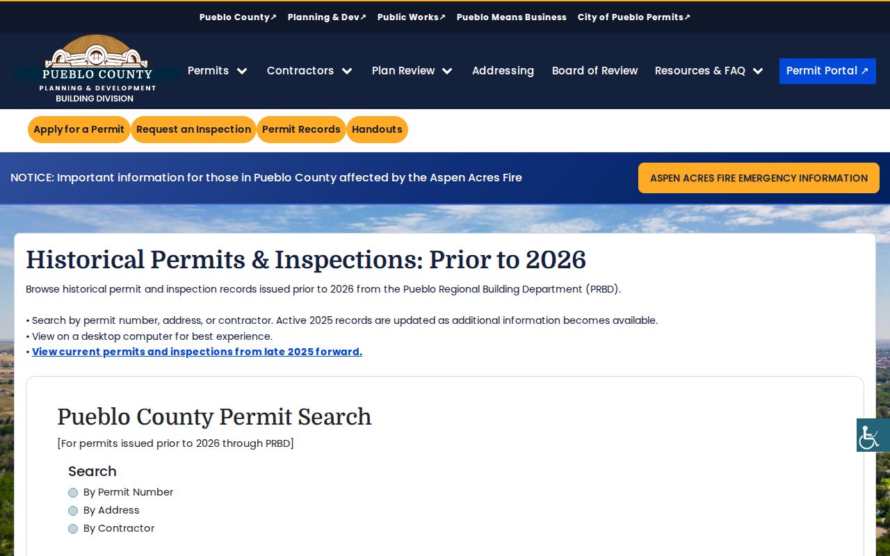
Read the permit number, address, contractor field, status, and inspection status together, then preserve the source date and jurisdiction.
Pueblo's 2026 Permit Route
City of Pueblo and Boone records moved to the Southern Colorado Building Department in 2026. SoCoBD lists public online services available 24/7, a front counter at 830 N Main, phone 719-543-0002, and public counter hours of 7:30 to 4:30. Its public landing page exposes login, permit, plan-review, licensing, report, and code links, but unauthenticated search fields were not verified.
The current City and Boone route is visible in the SoCoBD landing page.
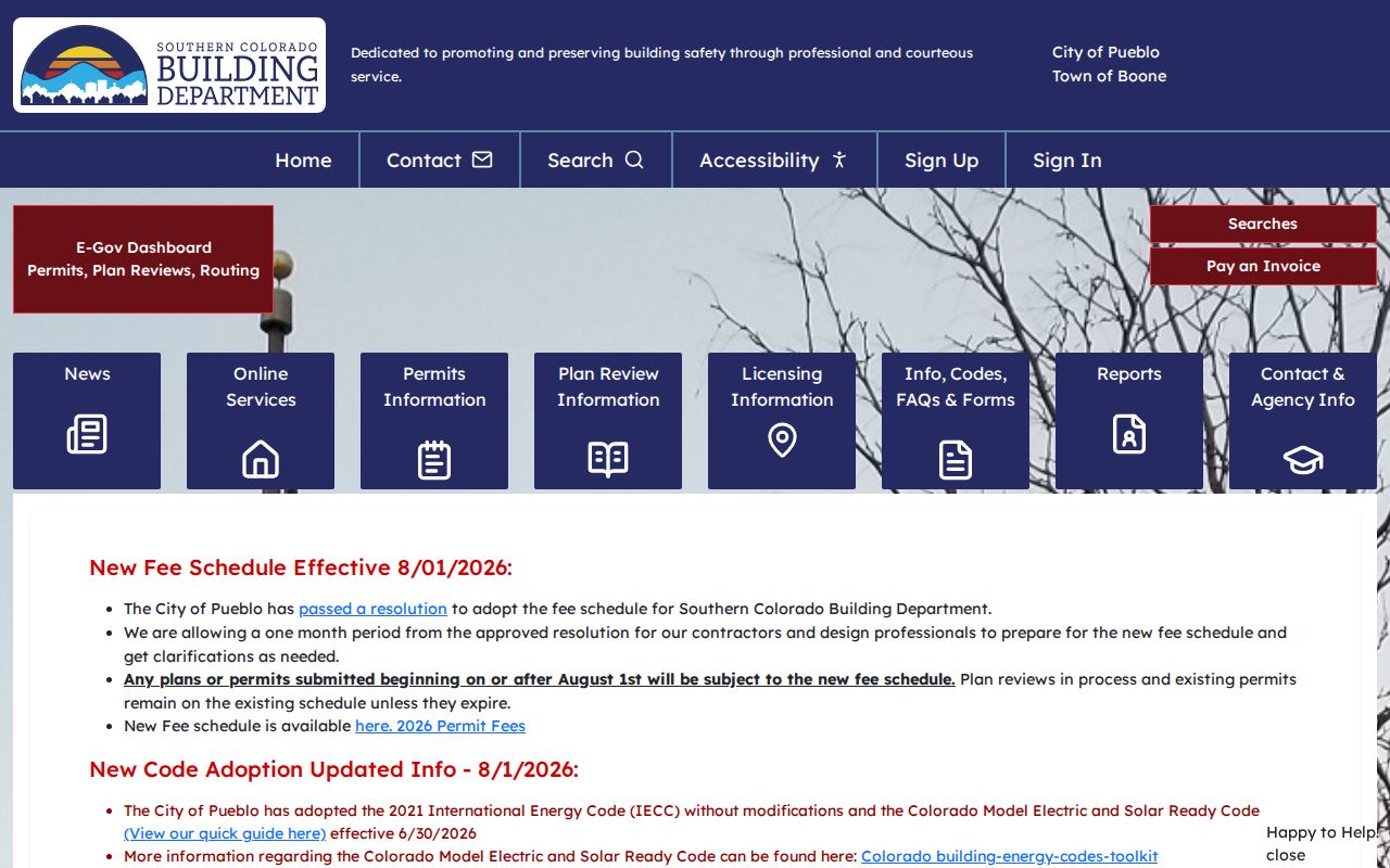
For an unincorporated parcel, use the County Building Division and its OpenGov route. Postal city text does not choose the custodian; the parcel’s physical jurisdiction and permit date do.
Pueblo Voter Clues Need a Date
The Colorado public voter lookup is not a street-wide directory. It asks for First Name, Last Name, ZIP Code, and Birthday in mm/dd/yyyy. The instructions say to use the name as registered and try a prior ZIP when a move may explain a no-result. A public result can provide a residence clue, but confidentiality rules can hide a protected voter or some voters under 18. Full name, residential address, affiliation, birth year, supplied phone, supplied gender identity, and prior-election participation are described as public fields subject to those protections. Social Security number, driver-license number, month and day of birth, signature, and email are confidential.
For a by-address or street question, contact Pueblo County Elections at 201 W 8th Street, seventh floor, 719-583-6620, or elections@pueblocounty.us, Monday through Friday from 8:00 to 4:30. The county Information Request form supports reports by name, physical address, mailing address, birth year, phone, registration date, party, voter status, district or precinct, and the last five or selected elections. It accepts mail at P.O. Box 480, email, or in-person delivery. The current form lists Excel reports at $125, daily files at $100 per day, email or thumb drive delivery at $10, and mailed thumb drive delivery at $20, with reports taking up to 72 hours after payment.
The SOS also accepts statewide data requests, while CORA can target a specific retained election record through the responsible custodian. County results, cast-vote records, archived election pages, library newspapers, and official minutes are historical alternatives. Do not use a staff-only lookup route to bypass a protected record.
Pueblo Aliases, Units, and Old Street Forms
A historical Pueblo address can look wrong because the street name, number, suffix, unit, or jurisdiction changed. The standards preserve alias roadway names for historical renaming or common use. The city and county also grew through separate communities, including Pueblo, South Pueblo, Central Pueblo, and Bessemer, with consolidation in 1886 and later annexation. The 1921 flood disrupted and rebuilt parts of the city. Those facts make a map, directory edition, deed, and current parcel record necessary companions.
When values disagree, preserve both forms: current assessor situs, current master address or planning record, recorder legal description or plat, the historical directory page, and any Sanborn or city packet reference. A unit such as 404 S 8TH ST UNIT 101 should not be merged with the base number. A private drive, stacked lot, rear structure, or separate establishment may have its own address clue. Search the original form first, then add a modern equivalent only when an official source supports it.
Pueblo ZIP and Last Lines Stay Separate
ZIP geography is a delivery layer, not a city or neighborhood boundary. The official USPS Pueblo location record places the main post office at 1022 Fortino Boulevard with last line Pueblo CO 81008-2025. Belmont, Midtown, and Sunset entries show other Pueblo delivery points in 81001, 81003, and 81005. The USPS AIS Viewer listed a July 27, 2026 release during research, but a current address-level lookup remains the controlling check.
Use the USPS ZIP Code Lookup in its address, city-and-state, or cities-by-ZIP mode. Enter the unit when one is present and preserve the retrieval date. USPS warns that a ZIP result does not prove a person or company is at the address. For a current delivery question, the Pueblo post office is the counter fallback. Keep the postal last line beside the assessor situs, parcel jurisdiction, neighborhood, and precinct rather than replacing one field with another.
Pueblo's Historical Street Index as a Check
The Pueblo Historical Society’s Edward Broadhead Library holds city directories from 1871, with Chieftain microfilm from 1868 through 1970, maps, yearbooks, cemetery information, oral histories, and vertical files. Street-list sections cover 1914 through 1927, with back-of-book street indexes after 1927; editions before 1914 may need page-by-page review. Rawlings Library adds local-history help, microfilm readers, obituary scans, catalog access, and staff guidance.
The 1886 Bessemer context shows why a name count cannot stand in for a street list: it counted 188 residents, yet about 80 had no street number. A directory entry can name an occupant, business, or occupation while omitting a usable number. For the full collection and reading method, the Pueblo city directory collections provide the historical shelf; the street chain here uses only the address clue needed to test a modern parcel.
Preserve the edition, page, reel or scan, exact street form, and whether the entry names a person, business, or household. A dated source is more useful than an unmarked name match.
Limits of a Pueblo Street Directory
A Pueblo street directory cannot show every person connected to a parcel. An assessor owner or tax mailing field does not prove current residence. A voter record is date-bound and may be confidential. DMV address data, utility customers, delivery records, and other household-member details are not public through the parcel method. A historical directory may lag a move or list a business at a mixed-use address. Treat each result as an owner, situs, voter, permit, or historical clue, not as a complete household roster.
The Colorado Address Confidentiality Program gives qualifying survivors a substitute legal address and mail forwarding. Confidential-voter rules can suppress a record, and a redaction pattern should never be used to infer a protected location. When a record is missing, ask the custodian about the permitted request or correction route rather than trying to reconstruct a protected address.
Lawful use. Pueblo street and address records are for personal, lawful research, family history, civic curiosity, and safety awareness. Do not use a street directory to stalk, harass, intimidate, or harm another person.